Lake Malawi cichlids — species, locations & maps
By genera
By locations
Locations
Maps
Posters
Interactive map
Photo Credits
Search
×
Copy link
Share
Facebook
Monkey Bay, Lake Malawi, Malawi
View cichlids from
Monkey Bay
Photo gallery
Monkey Bay, Thumbi East Island bottom left
Photo: © Ad Konings
Monkey Bay on final approach, 26-April-1971. Thumbi Island East below left.
The Malawi Railways dockyard (top left), Fisheries Research Unit (right of center), and landing strip (just beyond top left of bay) can be seen.
Photo: © Michael K. Oliver
Monkey Bay, Malawi: looking across the bay from the fishery research unit toward the dockyard, 1980.
Photo: © Michael K. Oliver
Swamp at Monkey Bay, Malawi, with the Chauncy Maples and Ilala in the distance, 1980.
Photo: © Michael K. Oliver
Monkey Bay, Malawi, 1971: a view from the peninsula to the south end of Thumbi Island East.
All the boulders and smaller rocks make a paradise for the mbuna, most of which feed on the algae growing in the shallow warm water.
The far shore of the lake's southeast arm is visible on the horizon.
Photo: © Michael K. Oliver
The Motor Launch Ethelwynn Trewavas, heading out of Monkey Bay, Malawi, on a day cruise in the Lake Malawi Trawling Survey, 1971.
Photo: © Michael K. Oliver
Monkey Bay, Malawi, 1971: the morning view from the bottom of David Eccles's garden. Thumbi Island East at left;
the east shore of the southeast arm in the distance, 25 km away. Note the weaverbird nests hanging from the foreground reeds.
Photo: © Michael K. Oliver
Another Lake Malawi sunset, looking east (yes, east) from David Eccles's garden at Monkey Bay, Malawi (1971).
Thumbi Island East is at left; the far shore of the southeast arm is seen in the distance.
Photo: © Michael K. Oliver
Monkey Bay
Photo: © Pam Chin
Monkey Bay
Photo: © Pam Chin
Monkey Bay
Photo: © Pam Chin
Monkey Bay
Photo: © Pam Chin
Larry Jonson at Monkey Bay
Photo: © Pam Chin
Monkey Bay. Thumbi East Island on the far left.
Photo: © Pete Barnes
◀
▶
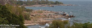
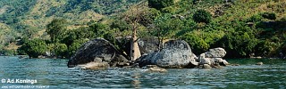
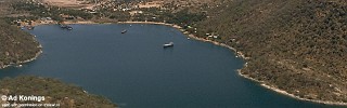
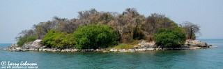
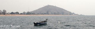
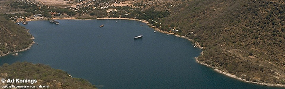
Photo gallery
Photo: © Ad Konings
The Malawi Railways dockyard (top left), Fisheries Research Unit (right of center), and landing strip (just beyond top left of bay) can be seen.
Photo: © Michael K. Oliver
Photo: © Michael K. Oliver
Photo: © Michael K. Oliver
All the boulders and smaller rocks make a paradise for the mbuna, most of which feed on the algae growing in the shallow warm water.
The far shore of the lake's southeast arm is visible on the horizon.
Photo: © Michael K. Oliver
Photo: © Michael K. Oliver
the east shore of the southeast arm in the distance, 25 km away. Note the weaverbird nests hanging from the foreground reeds.
Photo: © Michael K. Oliver
Thumbi Island East is at left; the far shore of the southeast arm is seen in the distance.
Photo: © Michael K. Oliver
Photo: © Pam Chin
Photo: © Pam Chin
Photo: © Pam Chin
Photo: © Pam Chin
Photo: © Pam Chin
Photo: © Pete Barnes